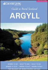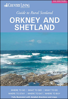
Orkney and Shetland
by UK Travel Guides
Free ebook download: Orkney and Shetland by UK Travel Guides, legally licensed and available in PDF format.
They are rich in historical sites and remains (far too many to mention them all in this travel guide), which show a continued occupation for thousands of years. Indeed, there are about 120 confirmed broch sites in the Shetland Islands alone. And because the landscape has never been intensely farmed or cultivated, many of these sites have remained relatively undisturbed.
In 1469, James III married Margaret, the young daughter of Christian I of Denmark and Norway. Her father pledged Orkney and Shetland to the Scottish crown until such time as the dowry was settled in full. As he was crippled with debts, the dowry was never paid. So, in 1472, the islands became part of Scotland, creating the kingdom of Scotland as we know it today.
The Norse influences are still strong. Gaelic was never spoken here, and the place names (and many family names) all have Norse derivations. Both sets of islands are nearer Oslo than they are London, and there have even been occasional calls for the islands to be independent of Scotland.
The Brough Ness on South Ronaldsay in Orkney is no more than eight miles from the Scottish mainland, while the Shetland Islands sit much further out to sea, with the distance between Sumburgh Head and the mainland being more than 100 miles. Few people realise the distances involved, as maps of the British Isles invariably put the Shetlands in a convenient box off Scotland’s northeast coast. However, fast ferries and air services put the islands within easy reach of the mainland.
In the distant past, they were at a major communications crossroads, and gained an importance that far outweighed their size.
They were on the main route from Scandinavia to Scotland, England, Ireland and the Isle of Man, and seafarers invariably stopped off there, some eventually settling. They are rich in historical sites and remains (far too many to mention them all in this guide), which show a continued occupation for thousands of years. Indeed, there are about 120 confirmed broch sites in the Shetland Islands alone. And because the landscape has never been intensely farmed or cultivated, many of these sites have remained relatively undisturbed.
The main difference between the two archipelagos can be summed up in the old saying that an Orcadian (an inhabitant of Orkney) is a crofter with a fishing boat, whereas a Shetlander is a fisherman with a croft. Orkney is therefore the more fertile of the two, though this is relative, as the landscape is nothing like the Scottish mainland farming areas, and trees are the exception rather than the rule. One thing has brought prosperity to the islands, however, and that is North Sea oil. It has transformed their economies, but at the same time has remained remarkably unobtrusive, apart from places like Sullom Voe in Shetland, the largest oil terminal and port in Europe.
The Orkney archipelago consists of about 70 islands, only 19 of which are inhabited. The largest island is Mainland, where the islands’ capital, Kirkwall, is located. It is a small city as well as a royal burgh, as it has its own medieval cathedral, the most northerly in Britain and the most complete in Scotland.
Kirkwall has a population of about 4800, and was granted its charter as a royal burgh in 1486. It sits almost in the centre of Mainland, and divides the island into East Mainland and West Mainland. It is a lively, busy place of old stone buildings and streets paved with flagstones, with a shopping centre that serves all of the islands. The old name for the town was Kirkjuvagr, meaning the church inlet, that church not being the cathedral, but the Church of St Olaf. All that is left of the early medieval building is a doorway in St Olaf’s Wynd.